solutions
VIAPIX Systems helps to evaluate the condition of a road network, to conduct a multi-year maintenance program, to prepare the work to reinforce a road section or to take delivery of construction site.
Depending on the customer’s needs, our system adapts and provides the information necessary for decision-making. This is why our auscultation equipment is modular and adaptable.
Our data acquisition controller records images of the environment and location data to allow remote analysis at the office. Less expensive and simpler than an in-situ analysis. Non-contact and non-destructive sensors make it possible to keep acknowledgment of the pavement condition.
The heart of the acquisition process is the VIAPIX Acquisition module, which works in conjunction with a set of sensors to accurately establish the state of the infrastructure.
VIAPIX ACQUISITION IS AN ALL-IN-ONE ROAD DATA COLLECTION SYSTEM
It brings together a set of high-resolution cameras capturing 180° panoramic images and a high-precision geolocation system. It is transportable and transposable to any vehicle.
Fixed by means of roof bars and powered by a cigarette lighter socket, it can be deployed in a few minutes.
We offer a wide range of ergonomic and reliable sensors, designed to meet the requirements of the management of road infrastructures, such as the inventory of assets and the analysis of pavement conditions.
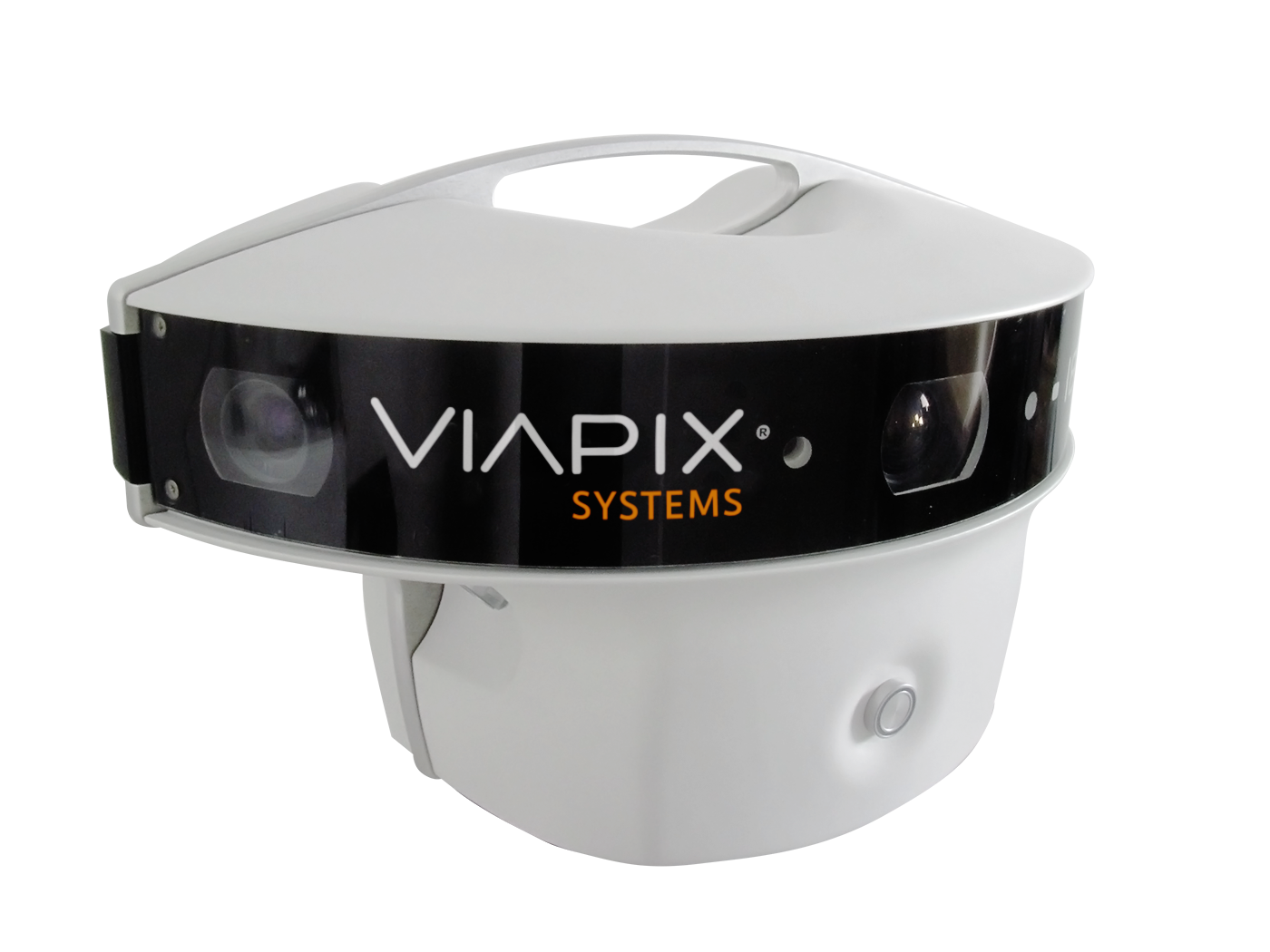
It has an internal memory allowing the storage of the equivalent of 600 km of survey.
The module is monitored by a WiFi tablet and provides the operator with the information necessary for systems’ configuration and diagnostics. The embedded software also enables the management of other pavement inspection sensors.

VIAPIX Acquisition est un système tout-en-un de collecte de données routières.
Il réunit un ensemble de caméras haute résolution capturant des images panoramiques 180° et un système de géolocalisation haute précision. Il est transportable et transposable à n’importe quel véhicule.
Fixé au moyen de barres de toit et alimenté par une simple prise allume cigare, il peut être déployé en quelques minutes.
Nous proposons un large panel de capteurs, ergonomiques, fiables et design permettant de répondre aux exigences de la gestion des infrastructures routières tel que l’inventaire de patrimoine et l’analyse de l’état des chaussées.
Il est doté d’une mémoire interne permettant le stockage de l’équivalent de 600 km de relevé.
Le module est piloté par une tablette tactile et restitue à l’opérateur les informations nécessaires au paramétrage et au diagnostic. Le logiciel embarqué permet de gérer également d’autres capteurs d’inspection de la chaussée.
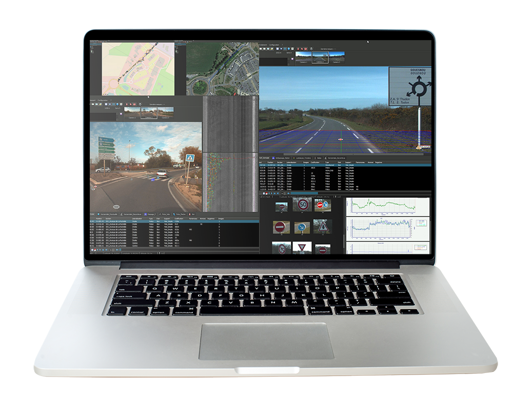
The information collected by our range of road auscultation sensors is also integrated into VIAPIX Exploitation.
The structural and surface indicators of the pavement are thus fully associated in the operating process.
The generated data is then transferred to a GIS or PMS through configurable software connectors.
VIAPIX EXPLOITATION IS A ROAD DATA PROCESSING AND ANALYSIS SOFTWARE.
Our software has a range of tools for consulting, producing and editing GIS data.
Based on the data provided by VIAPIX Acquisition, the solution makes it possible to digitize, inventory and qualify road equipment.
Our integrated image processing algorithms geolocate and measure all the elements existing in the image: traffic signs, road markings, existing pavement distresses, roadway lighting,…

VIAPIX Exploitation est un logiciel de traitement et d’analyse de données routières.
Notre logiciel dispose d’un panel d’outils pour la consultation, la production et l’édition de données SIG.
A partir des données fournies par VIAPIX Acquisition, la solution permet de digitaliser, inventorier et qualifier les équipements de la route.
Nos algorithmes de traitement d’image intégrés géolocalisent et mesurent tous les éléments présents dans l’image : panneaux de signalisation, marquage, dégradations, candélabres,…
Les informations collectées par notre gamme de capteurs d’auscultation routière sont également intégrées dans VIAPIX Exploitation.
Les indicateurs structurels et surfaciques de la chaussée sont ainsi pleinement associés dans le processus d’exploitation.
Les données générées sont ensuite transférées à un SIG ou un PMS au moyen de connecteurs logiciels configurables.
ROAD AUSCULTATION
In order to respond to road infrastructure maintenance and road-related safety issues, VIAPIX Systems designs and integrates a range of sensors additionally to the VIAPIX Acquisition module.
Our sensors measure:
- uni-longitudinal profile and IRI
- macrotexture
- transverse profile
- road geometry
- pavement surface condition
These data help to precisely qualify the pavement distresses according to the roadway infrastructure standards.
VIAPIX DLP IS A PORTABLE SOLUTION FOR MEASURING DEFORMATION OF LONGITUDINAL PAVEMENT PROFILE.
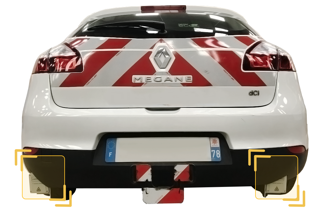
Equipped with 1 or 2 LASER, it restores the uni-longitudinal and texture indicators.
This equipment is installed in a few minutes at the rear of the vehicle on the towing hook, it is powered by the cigarette lighter socket.
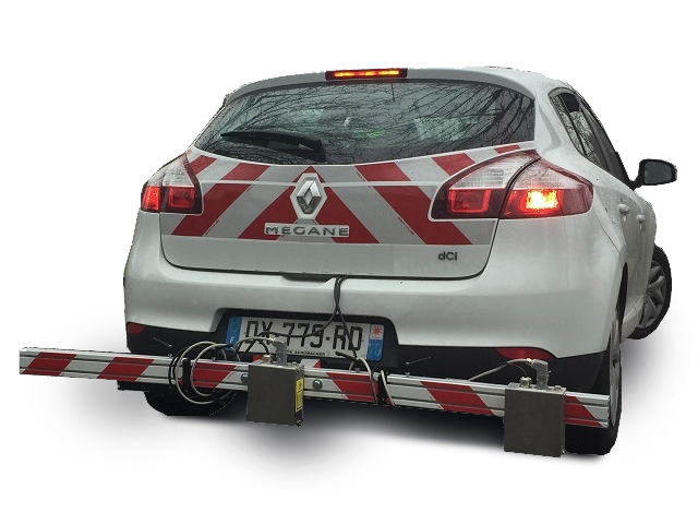
Due to the multitude of indicators returned, it is mainly used before, during and after the works phase.
It is particularly relevant for monitoring the aging of the wearing course.

VIAPIX DLP est une solution portable pour mesurer la déformation du profil longitudinal de la chaussée.
Équipé de 1 ou 2 LASER, il restitue les indicateurs d’uni-longitunal et de texture.
Cet équipement est installé en quelques minutes à l’arrière du véhicule sur le crochet d’attelage, il est alimenté par la prise allume-cigare.
De par la multitude d’indicateurs restitués, il est principalement utilisé avant, pendant et après la phase de travaux.
Il est particulièrement pertinent pour suivre le vieillissement de la couche de roulement.
VIAPIX GEO also calculates the radius of curvature of bends on a given route, in order to offer a complete lane geometry measurement solution.
These indicators are necessary to characterize surface water flow, visibility distance and cornering grip.
VIAPIX GEO IS A SOLUTION FOR MEASURING PAVEMENT GEOMETRY.
Consisting of 3 LASER rangefinders, this sensor accurately restores the transverse and longitudinal slope of the road, qualifying the cant and the gradient, respectively.

VIAPIX GEO est une solution pour mesurer la géométrie des chaussées.
Constitué de 3 télémètres LASER, ce capteur restitue avec précision la pente transversale et longitudinale de la route, qualifiant respectivement le dévers et la déclivité.
VIAPIX GEO calcule également le rayon de courbure des virages sur un itinéraire donné, afin d’offrir une solution complète de mesure de géométrie des voies.
Ces indicateurs sont nécessaires pour caractériser l’écoulement des eaux en surface, la distance de visibilité et l’adhérence en virage.
VIAPIX PFT IS A PORTABLE SOLUTION FOR MEASURING PAVEMENT CROSS-PROFILE DEFORMATION.
Designed around a high-precision LIDAR, this sensor identifies ruts, unevenness, bulging and subsidence.
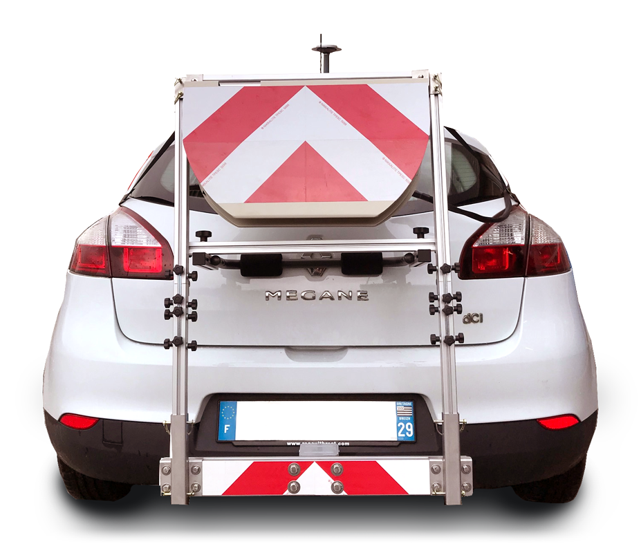
Easily transportable, it is installed in a few minutes at the rear of the vehicle on the towing hook, it is powered by the cigarette lighter socket. The indicators returned make it possible to qualify the structural condition of the roadway as well as the comfort and safety conditions for users.

VIAPIX PFT est une solution portable pour mesurer lA DEFORMATION DU PROFIL TRANSVERSAL DE LA CHAUSSEE.
Conçu autour d’un LIDAR haute précision, ce capteur identifie les ornières, la déplanéïté, le bombement et l’affaissement.
Facilement transportable, il est installé en quelque minutes à l’arrière du véhicule sur le crochet d’attelage, il est alimenté par la prise allume-cigare. Les indicateurs restitués permettent de qualifier l’état structurel de la chaussée ainsi que les conditions de confort et de sécurité des usagers.
The automatically calculated indicators make it possible to qualify the surface and structural condition of the pavement:
- Longitudinal profile
- Transverse profile
- Macro-texture
- Gradient and cant
- Radius of curvature
- Cracks and crazing
- Potholes and pull-outs
- Penetrant and frosting
- Localized repairs
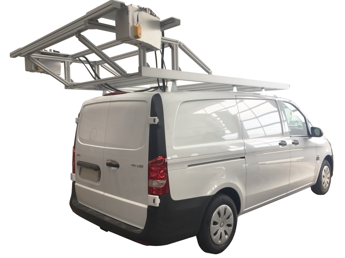
VIAPIX SYSTEMS, A RECOGNIZED AND CERTIFIED PAVEMETRICS INTEGRATOR, OFFERS AN INTEGRATION OFFER FOR THE LCMS (LASER CRACK MEASUREMENT SYSTEM) SOLUTION
This very high-tech data collection system is controlled by a VIAPIX Acquisition module which supervises and controls the measurements.
Combining robust mechanics, reliable electronics and user-friendly software, the solution synchronizes the acquisition of LCMS indicators and VIAPIX Acquisition data.

VIAPIX Systems, intégrateur reconnu et certifié PAVEMETRICS, propose une offre d’intégration de la solution LCMS (Laser Cracks Measurement System)
Ce système de collecte de données, de très haute technologie, est piloté par un module VIAPIX Acquisition qui supervise et contrôle les mesures.
Alliant une mécanique robuste, une électronique fiable et un logiciel ergonomique, la solution synchronise l’acquisition des indicateurs LCMS et les données VIAPIX Acquisition.
Les indicateurs calculés automatiquement permettent de qualifier l’état surfacique et structurel de la chaussée :
- Profil longitudinal
- Profil transversal
- Macrotexture
- Déclivité et devers
- Rayon de courbure
- Fissures et faïençage
- Nids-de-poule et arrachements
- Ressuage et glaçage
- Réparations localisées
