

Production of GIS data, from panoramic images
- Direct use of data from viapix acquisition
- Constitution and update of road database (images, inventories, pavement evaluation, …)
- Construction of the road reference (x, y, pr + abs and accumulation)
- Automatic inventory of road assets (vertical signage, horizontal signage, …)
- Blurring (faces, license plates, …)
- Collaborative work (network data sharing, connection to several on a measurement companion)
IN-IMAGE MEASUREMENT
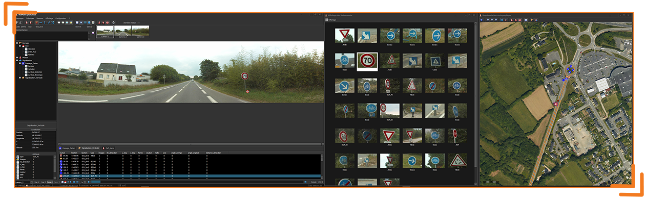
- Panoramic navigation on the road network from your desktop
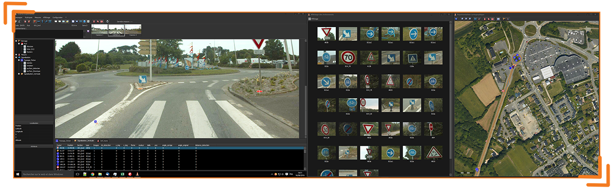
- Visualization of the information captured in the image
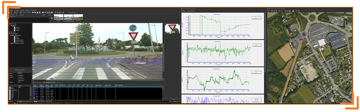
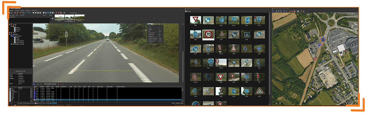
- Measurement in 3 dimensions (length, width, height)
- Calculation of ground surfaces (pedestrian crossing, road repair, …)
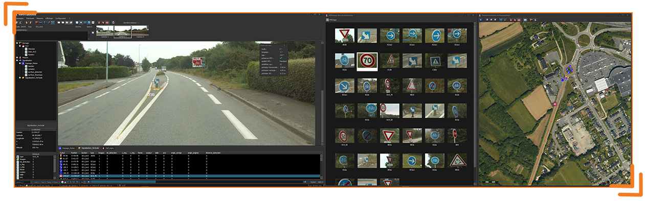
DATA EXPLOITATION
At the end of the survey campaign, the data is downloaded in order to be processed in the VIAPIX Exploitation software. The information generated as well as the calculated indicators can be exported, in a standard format, to your geographic information system (S.I.G.) or your road database.
STATEMENT OF OBJECTS
- inventory of road assets (seizure of objects: bus stops, streetlights, signage, …)
- calculation of the geographical position of each element pointed in the image
- conducting the pavement diagnosis (reporting the degradation, …)
- natural (l1) horizontal accuracy 2 m
- dgps mode (l1) horizontal accuracy 0,4 m
- rtk mode (l1/l2) horizontal accuracy 10 mm + 1 ppm x reference station distance (optional)


Cartographic representation
- Visualization of the objects entered on a cartographic background
- Selection of the type of object to display
- Integrated business library
- Operation with a powerful 2d rendering engine
- Thematic layers
Data export to GIS:
- KMZ (Google Earth)
- MIF / MID (Mapinfo)
- SHP (ESRI)
- CSV (Excel)