

Field of use
The VIAPIX Systems acquisition solution is intended for the acquisition and processing of road data. This mobile video mapping system, allowing high-performance surveys to be conducted, is associated with powerful operating software.
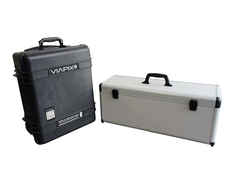
The embedded module, compact and portable, is easy to use. It is a low-power, high-performance, open and scalable acquisition platform.

Constitution and characteristics
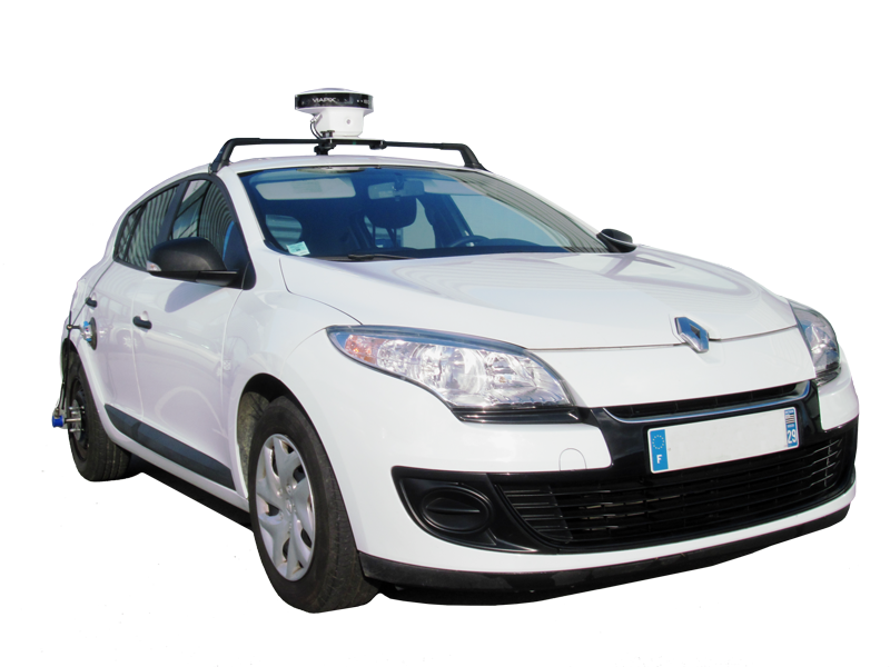
The proposed technical solution combines a panoramic imaging system, a satellite positioning module, and a hybrid navigation solution. A Wi-Fi tablet is used to control the system.
This product, created for the precise georeferencing of data that can be used in the office, is also the heart of a modular architecture that can control many sub-functions integrating various sensors.
The multifunction offer is particularly suitable for road diagnostics and complementary to the road asset inventory function.
Hardware
PANORAMIC Imaging
- Three colour cameras for 180° shots
- High-sensitivity 2 M pixel camera, i.e., nearly 6 M pixels in panoramic
- Real-time JPEG compression
- 192 GB storage capacity (up to 300 km at 1 m acquisition step)
- Possibility of combining two modules for 360° shots
- Resolution per camera: up to 1600×1200 Pixels @ 25 img/s
geolocation
- 72-channel GNSS receiver, dual-frequency L1/L2 GPS, GLONASS, SBAS
- Differential corrections (RTCM)
- Performances
- Natural (L1) Horizontal Accuracy 2 m
- DGPS Mode (L1) Horizontal Accuracy 0,4 m (Option, contact us)
- RTK Mode (L1/L2) Horizontal Accuracy 10 mm + 1 ppm x reference station distance (Option, contact us)
Data exploitation
At the end of the survey campaign, the data is downloaded in order to be processed in the VIAPIX Exploitation software. The information generated as well as the calculated indicators can be exported, in a standard format, to your geographic information system (S.I.G.) or your road database.
HYBRID NAVIGATION (GPS MASKING COMPENSATION)
- 3 Gyroscopes, 3 Accelerometers and 3 Magnetometers based on MEMS technology
- Configurable extended Kalman filter
- GPS-RTK Interfaces
- Odometer (high resolution optical encoder > 1024 pts/tr)
- Performances
- Roll / Pitch 0,1° RMS
- Heading (Dynamic) < 0,5° RMS
- Resolution < 0,05°
User Application
- Wi-Fi tablet with protective cover
- Wi-Fi 802-11g connectivity and 4G mobile telecommunications
- Compatibility with any HTML5 web browser
- Cartography compatible with Google Maps and MIF/MID format for real-time tracking
- Management of field readings / Event mapping
Technical characteristics
- 9-28 VDC power supply
- Typical consumption 26 W
- Waterproof case IP64
- Weight 3,5 kg
- Mounting vehicle on roof bar (not supplied) and suction cup
- Universal system for fixing the encoder on the wheel of the vehicle)